
ZULU 7
Landsat 7 false colour mosaics

|
|
ZULU 7
| |
The African set of Landsat 7 false colour mosaics on DVD
Landsat 7 with its 15m/pixel panchromatic sensor has redefined mapping of remote areas and given a new dimension
to the term high definition satellite imagery.
In a bold move NASA has now released to the general public these
fantastic images which until recently were only accessible by national government and multinational
corporations. African GIS has now taken a new meaning: finally it has become possible to map
inaccessible regions of the continent up to a scale of 1:50.000 using just a personal computer
and a limited budget.
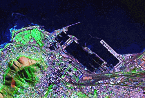
Cape Town harbour. Resolution 14,3m/pixel
MadMappers brings you the complete African collection of Orthorectified Landsat Thematic Mapper Mosaics
better known as Zulu 7, over 30Gb of highly compressed satellite images in false colour.
ZULU 7 DVD #1: Southern Africa & Indian Ocean Islands
The mosaicked Landsat 7 images, dated from 1999 to 2002, were produced, under NASA
contract, by Earth Satellite Corporation. Processing was done in the infrared spectrum by pan-sharpening
3 colour bands chosen for maximum contrast:
• Band 7 (mid-infrared light) displayed as Red,
• Band 4 (near-infrared light) displayed as Green and
• Band 2 (visible green light) displayed as Blue
Since of the infrared processing the colours are not real, for
instance vegetation is represented by shades of purple (not pleasing to the
eye but you can distinguish types of vegetation, for example sugarcane fields
are light pink). Another example is water: cold water is black and warm water
is light blue (useful if you have to pick the warmest spot of the beach for a swim).
Zulu 7 images differ from Zulu 5 in age (year 2000 vs. year 1990), in resolution (14,3m/pixel, which is roughly
equivalent to scale 1:56 000, vs. 28,5m/pixel scale 1:115 000) and in size: they are very large,
of the order of
250Mb per tile. Because of their wavelet compressed format (MrSid) a system with a minimum of 128Mb RAM is
recommended.
The name Zulu: it is the name of the NASA server
which hosts these images (https://zulu.ssc.nasa.gov), it is African and we like it. Because of their size they are not for
download by
the faint hearted (even if by ADSL and
particularly if limited by a traffic cap). Much easier, quicker and cheaper to get the MadMappers DVD set
which includes Oziexplorer calibration files and is ready to be loaded directly from
the DVD rom drive!
• Coverage:
Show coverage map
Complete country coverage: Comoros, Lesotho, Namibia, Madagascar, Mauritius, Reunion, South Africa, Swaziland, Zimbabwe;
Partial country coverage: Angola, Malawi, Mozambique, Zambia
• Format:
MrSid
a free viewer is available from Lizardtech
• Calibration:
Oziexplorer and world file included
• GIS software compatibility:
Oziexplorer and Global Mapper compatible
check screen shotMADMAPPERS PRICE:
• Coverage:
Show coverage map
Complete country coverage: Burundi, Rwanda, Sao Tome', Seychelles, Tanzania;
Partial country coverage: Angola, Congo, DRC, Gabon, Kenya, Malawi, Mozambique, Somalia, Uganda, Zambia
• Format:
MrSid
a free viewer is available from Lizardtech
• Calibration:
Oziexplorer and world file included
• GIS software compatibility:
Oziexplorer and Global Mapper compatible
check screen shot
MADMAPPERS PRICE:
R 150,00 / US$ 25,00
plus postage
• Coverage:
Show coverage map
Complete country coverage: Equatorial Guinea,
Partial country coverage: Benin, Burkina Faso, Cameroon, C.A.R., Chad, Congo, DRC,
Ethiopia, Gabon, Ghana, Ivory Coast, Kenya, Nigeria, Somalia, Sudan, Togo,
Uganda
• Format:
MrSid
a free viewer is available from Lizardtech
• Calibration:
Oziexplorer and world file included
• GIS software compatibility:
Oziexplorer and Global Mapper compatible
check screen shotMADMAPPERS PRICE:
R 150,00 / US$ 25,00
plus postage

• Coverage:
Show coverage map
Complete country coverage: Capo Verde, Senegal, Gambia, Guinea, Guinea Bissau, Sierra Leone, Liberia, Ivory Coast, Benin, Togo, Ghana, Burkina Faso
Partial country coverage: Mauritania, Mali, Niger, Chad, Nigeria
• Format:
MrSid
a free viewer is available from Lizardtech
• Calibration:
Oziexplorer and world file included
• GIS software compatibility:
Oziexplorer and Global Mapper compatible
check screen shotMADMAPPERS PRICE:
R 150,00 / US$ 25,00
plus postage
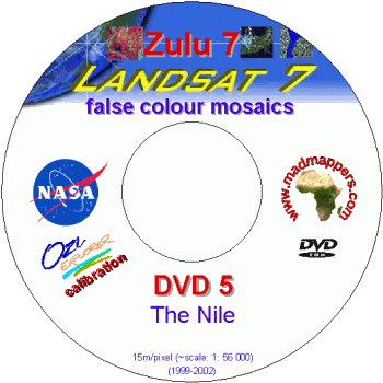
• Coverage:
Show coverage map
Complete country coverage: Egypt, Eritrea, Djibouti,
Partial country coverage: Sudan, Ethiopia, Somalia, Chad, Central African Republic
• Format:
MrSid
a free viewer is available from Lizardtech
• Calibration:
Oziexplorer and world file included
• GIS software compatibility:
Oziexplorer and Global Mapper compatible
check screen shotMADMAPPERS PRICE:
R 150,00 / US$ 25,00
plus postage

• Coverage:
Show coverage map
Complete country coverage: Morocco, Tunisia, Western Sahara,
Partial country coverage: Algeria, Mauritania, Mali, Niger, Chad, Lybia
• Format:
MrSid
a free viewer is available from Lizardtech
• Calibration:
Oziexplorer and world file included
• GIS software compatibility:
Oziexplorer and Global Mapper compatible
check screen shotMADMAPPERS PRICE:
R 150,00 / US$ 25,00
plus postage
The ZULU 7 Africa collection - 6 DVDs
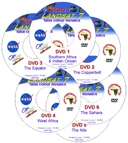
• Coverage:
the African continent in a 6 DVDs set
(DVD #1 to DVD # 6)
• Format
MrSid
a free viewer is available from Lizardtech
• Calibration:
Oziexplorer and world file included
• GIS software compatibility:
Oziexplorer and Global Mapper compatible
R 900,00 / US$ 150,00
FREE postage WORLDWIDE !!!
|
Welcome to the MadMappers community! Raster Maps | GPS Maps | Vectors | DEM | Satellite Imagery | Aerial PhotosHOME | NEWS | GIS TOOLS | FORUM | GALLERY | MAPSETS on CD | DISCLAIMER | CONTACT US © 2005 www.madmappers.com |